Gallery 2 - A Pilot's View > Aerial Landscapes > Rivers of the Southwest
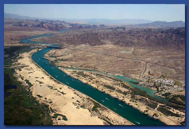
Needles, California, named after the pointy mountains here, is a tourism recreation area near the border of California and Arizona in the Mojave Desert. The Colorado River runs through and gives relief to the extreme hot temperatures. It can get up to 50 degrees C in the summer!
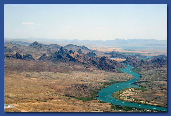
The green color of the Colorado River is caused by the algae bloom in the spring snowmelt from up north in the Rockies. Some parts of the Colorado River is often a muddy red color because of suspended reddish silt in the water like in the Grand Canyon.
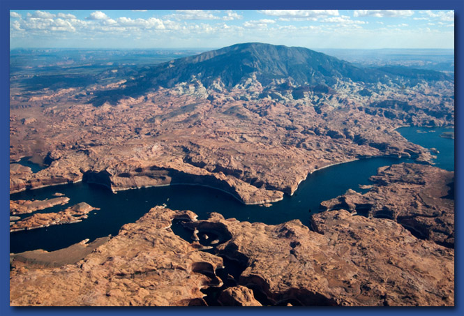
Not technically a river, Lake Powell is the result of the flooding of the Colorado River in Utah by the Glenn Canyon Dam north of the Grand Canyon.
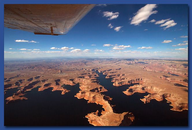
Lake Powell is now a major vacation spot with around 2 million people visiting every year.
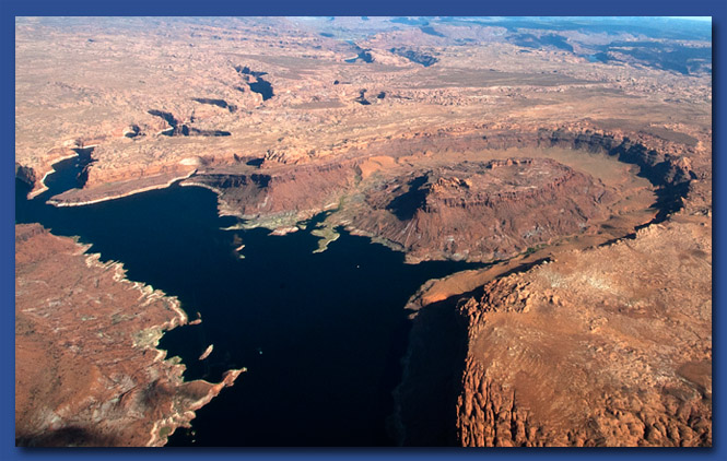
The white 'bathtub ring' at the surface of the water is the result of low water levels. Here a butte didn't quite get flooded.
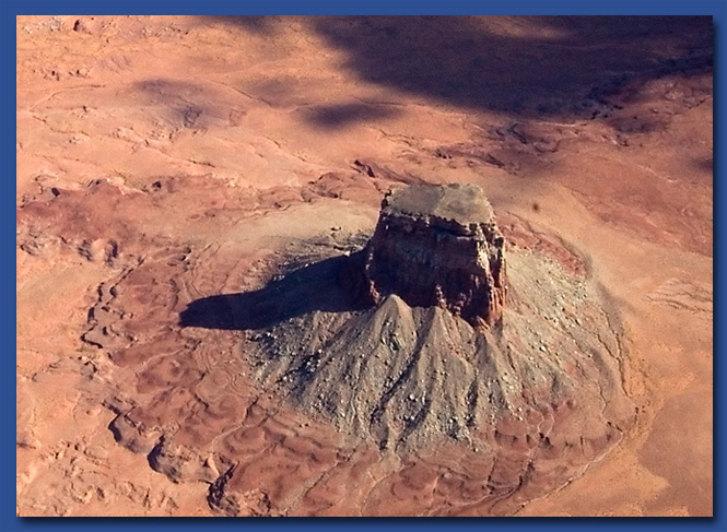
Another butte near Lake Powell called Tower Butte. This butte is a tourist attraction. You can take a helicopter ride that lands on the flat top for beautiful views and photos of Lake Powell. Doesn't look tall from the air but it rises 1600 feet above the ground!
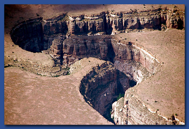
Deep River Canyons between Sedona and Winslow, Arizona. It does rain in the desert, and when it does, it pours. Photo taken in May, 2009.
On another trip in 2010, we flew across Arizona again on our way to a conference in California. Deep river canyons near Winslow, Arizona really shows the power of water over rock. This is part of Clear Creek Canyon and is hundreds of feet deep!
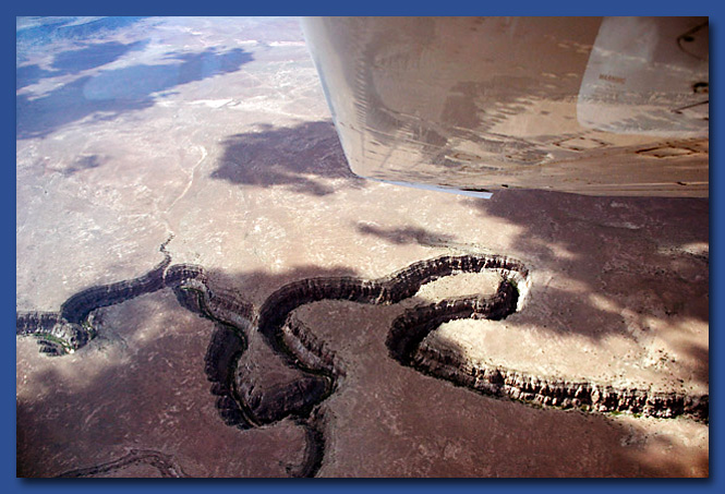
Many people rappell down these canyons and explore the floor before climbing back out. Sounds fun, but we like to just fly over them.
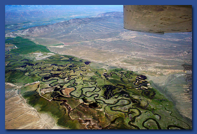
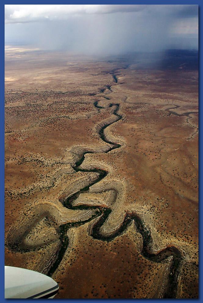
Near the Utah, Wyoming border were interesting winding rivers. These very controlled river systems really stand out against the dry desert lands of the southwest.